Some days, hitting the trail really feels like work before you get going. Last night I didn’t get nearly as much sleep as I would’ve liked, and I considered not hiking today. But I know once I get out and begin to feel the gravel under my boots, I’ll be much happier than when I began the day.
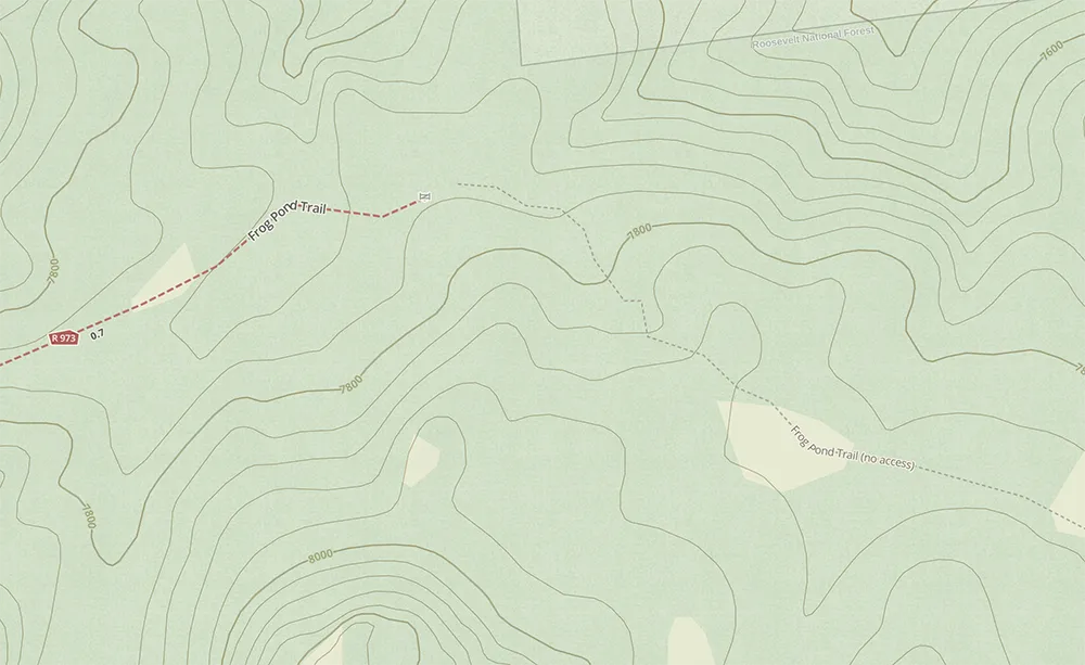
Today I left from the Mount Margaret trailhead and headed toward a point on the map that was beyond the trail. I was curious to see if I could get to that little pond, or if there’s something that will stop me where the trail is marked as ending on the map.
So I tossed on the backpack, grabbed my hat, and hit the trail, knowing that in an hour or so I would feel revitalized and energized by being out in the forest.

Oh, the best laid plans. The trail I had seen on the map that I planned to take was closed. It looked like there had been a chunk of trail damage, so I hopped onto the trail number 979 and decided I would probably head to the Frog Pond Trail, but it would be a little bit longer if I wanted to try to reach that point that was marked as closed on the map.
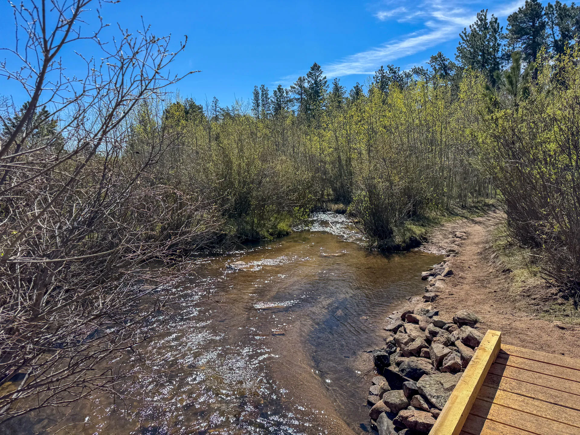
On the Mount Margaret Trail (979), about 3/4 of a mile in, the trail dives into a grove of Aspen trees, and a little bridge across the creek awaits you on the other side

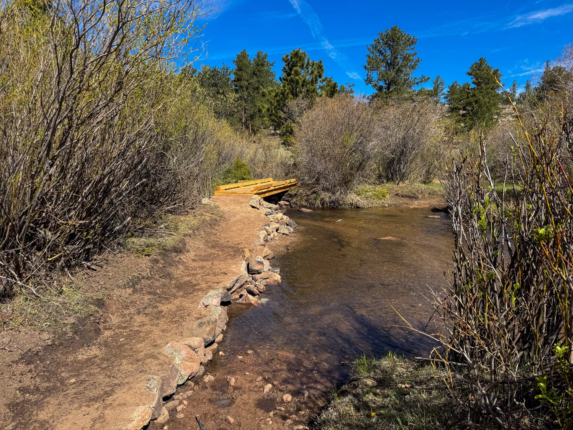
After the recent snowstorm, the creeks are all running slightly higher, and they certainly make for a beautiful pictures.
I cut off the trail to do a little bit of full-on forest bathing. Without being on the trail, I thought, well, I might go pick up that closed trail I had decided not to go down this morning.
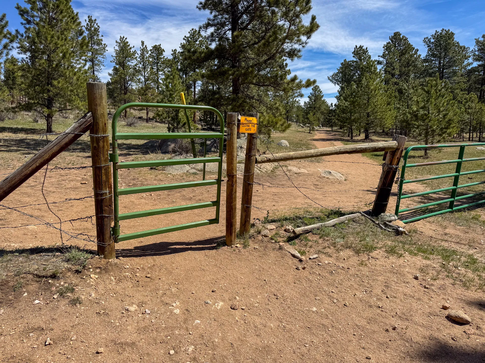
I appear to have found out part of why that might be closed. I don’t know if this is a private land boundary or what, but there is a barbed wire fence that I’m not gonna get through, so I guess I’ll be heading back to the Mount Margaret Trail, and going from there

Well, there were a few places along the fence I probably could’ve crossed over, but I decided to keep pushing toward the 979 trail
I did come across a downed place on the fence line that looks like it might’ve once had a forest boundary sign.

Well, crap, that fence line was probably just one that a rancher had put up whenever they leased some land from the Forest Service, as I’ve now intersected with the Mount Margaret Trail, and it goes through this fence line.
So I probably could’ve plowed through the forest and just stepped over the fence, but it’s the United States. It’s safer not to get shot by some rancher, who’s all worked up because you’re on their property.
These little Aspen groves are just starting to have their leaves bud out, and it’s so much prettier than it was a few weeks ago when I came and hiked this trail to shoot the videos for the assessment on TheHikingCEO.com.

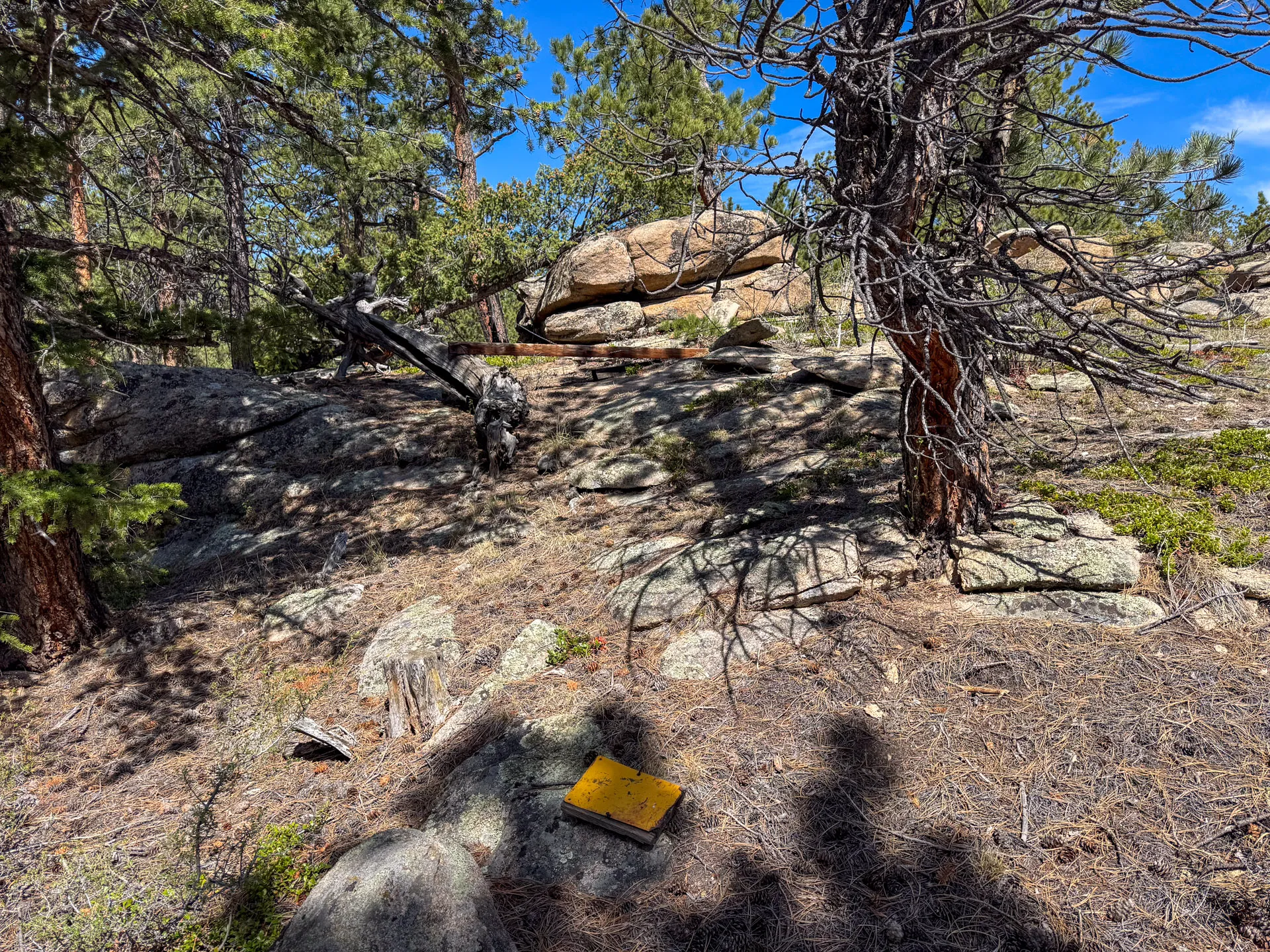
In days long past, the Forest Service would provide a fire grate, a bench, and sometimes a picnic table along different popular trails. While this trail is no longer all that popular. It looks like there are more mountain bikers who ride along here than hikers. It’s great to have a place to sit down for a few minutes and decide whether I’m gonna keep going or call it quits and begin trekking back.

About a half mile from the official forest campsite, I found what I’m sure is the official end of the trail, which goes through some barbed wire that was cut and rolled back.
It looks like there was probably a sign here at one point. I didn’t see it anywhere. I decided I would go a little bit further, just to see what’s around the corner, and decide whether to turn around or keep going.

I didn’t go too far past the end of the trail marker. If I’d had more energy, I probably would’ve tried to go down to Frog Pond, but my guess is Frog Pond is probably not much more than a puddle right now, considering how little precipitation this area has received this year.
So I turned around and headed back toward the trailhead.
If I’d had more energy, there were some really cool rock formations that would’ve been a blast to scramble up on, but after over 4 miles and being as out of shape as I am, my body said nope, no climbing, get back to the trailhead, get your feet up!

At about the 5 1/2 mile mark, I realized I was totally wiped out. I mean, seriously, somebody get some butter and jam because I was toasted!
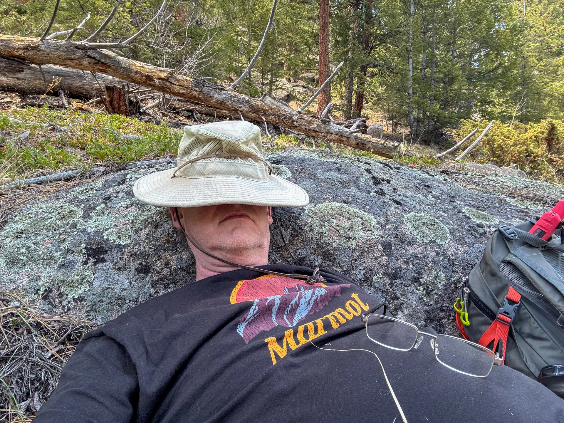
Fortunately, I came across a nice rock in the shade that looked like it wouldn’t be too terribly uncomfortable, where I could kick back and rest for a little bit and munch on a granola bar.


In the distance, Steller’s jays chattered, while a red-breasted nuthatch tweeted. I’m not sure how long I hung out at the rock, but after eating the granola bar, I definitely started to feel a little more energetic. The temperature was moving well into the 60s now, and while certainly nowhere near oppressive, it was starting to feel warmer than I’ve been used to.
These last few months hanging out at my mom‘s house in Northern Colorado have been a seriously mixed bag from a business perspective. I spent a good chunk of the winter building up one of my businesses, and there’s really no other way to say it: it failed.
I’m honestly a little bit cranked with myself over that. This is a business I have tried to build up multiple times, and each time I’ve been able to increase income, only to have it crater after the initial promotion.
It’s absolutely emotionally draining and frustrating to watch myself do this again when I could have focused on other opportunities
So for the last month or so, I’ve been working on building a business I’ve long pondered. I am about sick beyond belief of the customer service at the aforementioned business. I really want to do something where either the customer service radically changes or I do significantly less of it.
Years ago, I bought a number of domains and haven’t done much with them, but now I’m taking TheHikingCEO.com and turning it into a website for people interested in building their own online business. The business model that I’m pursuing is a combination of affiliate marketing and digital products.
I’m really excited to dive into building an SEO-focused website to drive traffic to affiliate offers and digital products.
A little over a year and a half ago, I built a men’s health website that just sat there. I had a chunk of traffic off of the 22 blog posts, and I really didn’t think too much of it. I built this site to see if I could get traffic to a website in a highly competitive space, and I did; I got up to almost 2000 visitors a month.
Then, as I began working on TheHikingCEO.com, my men’s health website got its first affiliate sale! The traffic, of course, had fallen off, but I decided I would go ahead and put up a couple more posts to see if I could get another affiliate sale.
So I’m not exactly sure when I’m gonna hit the road and get back to my awesome travel lifestyle. For the time being, I am going to be focusing on building these two website businesses.
It will likely take at least a year for either of them to begin producing any significant revenue, but man, am I excited to be moving down a different path – one that feels more authentic and aligns better with who I am
——
After closing my eyes for a little bit and enjoying listening to all the different birds, including northern house wrens, pine siskins, American robins, and yellow rump warblers, I got back up, started what I was afraid would be a bit of a long March to the trailhead and my jeep.
As I got back to the creek, where I had crossed the bridge earlier in the day, I discovered what I had been a little bit nervous about.
Since I had left the Mount Margaret Trail and was following what may have been a closed trail, I had no idea whether there would be another bridge.
Unsurprisingly, there was no bridge to cross here.

Fortunately, just a little upstream, I found a log that had washed down, or more likely, someone had placed it here. I decided that this was how I’d cross, and I’ll either make it across dry or be completely wet for the rest of the day.

I managed to cross on the log and stay dry. However, I do have to admit I used the rocks for balance as I walked across. The log was a little loose and rolly.
Before I reached the trailhead, I came across what was once a sign and perhaps a gate. A few of the posts remain; the wood that held the sign lies beside them, waiting to be reclaimed by Mother Nature. Barbed wire wraps around the posts, holding them in place as a reminder of what once was.

There’s always a sense of satisfaction when the trailhead comes into view. Today’s hike didn’t even register in my top 50 longest hikes. But a winter of little physical activity and my Mom’s wonderful home cooking, and I am definitely not in great shape.

While I was insanely tired and completely exhausted, hiking always gives me an intense experience of satisfaction.
I love pounding out the miles, wandering through the forest, and sitting on the rocks. We are part of the natural world, and whenever I’m away from other human beings in such a beautiful setting, I’m reminded that we’re only a tiny spec on a giant timeline and that we should respect and love this rock that’s spinning through space
